Trip Journal: April 20-26, 2022
The Blue Ridge Escarpment is a place of transition where the high mountains of Western North Carolina drop dramatically into the Piedmont of South Carolina and Georgia below. Steep elevational drops, high rates of precipitation, and warm temperatures characterize the landscape. I travel to the escarpment to lead a one-to-one photography adventure, as well as to revisit and reshoot the landscapes of my past.
Spring / April 2022 / Mark VanDyke
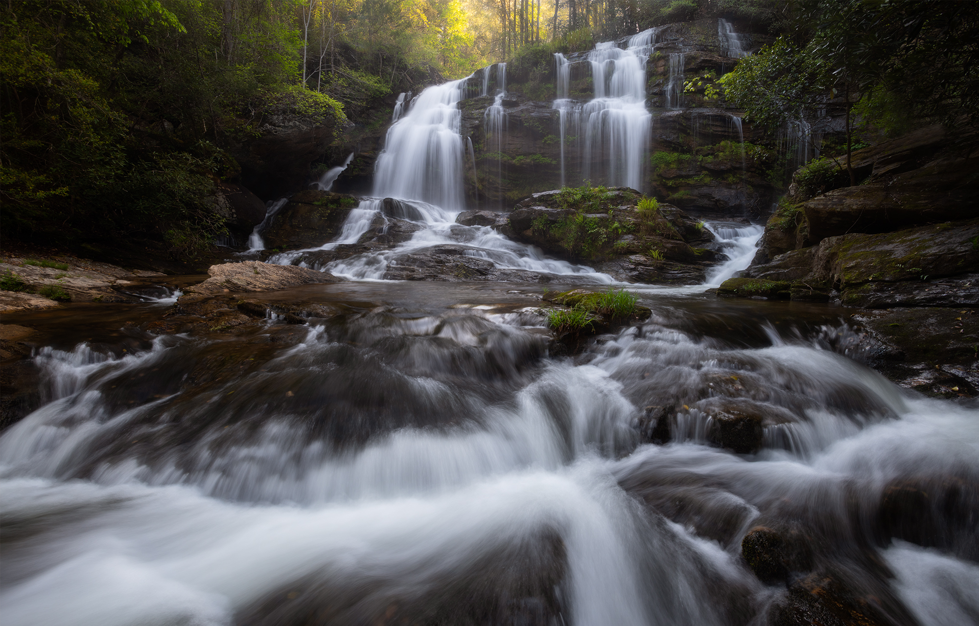
I learned the camera here. It wasn’t the first place. But it was the most consistent place. I lived within the shadow of the Blue Wall at a time in my life when adventure and creativity had great space to flourish. These landscapes will always be meaningful to me.
If you open a map of the east coast and navigate to the largest expanse of green protected lands, you’ll likely find yourself squarely within the Southern Appalachian Mountains. Great Smoky Mountains National Park and the Blue Ridge Parkway capture the national attention. But, it’s the surrounding National Forest lands that actually dominate the map–The Chattahooche, Nantahala, Pisgah and Cherokee National Forests. I moved to Upstate South Carolina at eighteen for college and quickly fell for the forests. At first it was mountain biking, trail running and kayaking. I was young and my adventure was fast. As the years have advanced, I’ve taken to the camera and the slower art of “seeing” that is photography.
My focus for this trip will be on the southeastern edge of the Appalachian Mountains. This fast-falling transitional zone is known as the Blue Ridge Escarpment. The Cherokee had a name for this place, too: The Blue Wall. By definition, the Blue Ridge Escarpment–or Blue Wall–is the land within the Blue Ridge physiographic province between the continental divide (a ridge separating The Atlantic and The Gulf of Mexico drainages) and the Piedmont. The Southern Blue Ridge Front is further defined as the area from Linville Gorge in North Carolina to Tallulah Gorge in Georgia.
Basecamp will be located at Oconee State Park and I’ll be working, primarily, two river gorges–the Chattooga and Chauga Rivers–both part of the Savannah River drainage. Sumter, Chattahooche and Nantahala National Forests will provide the canopy for my adventure. The continental divide, or northernmost point of the Blue Wall for my trip will be up in Highlands/Cashiers, North Carolina. The Piedmont, or southernmost point of the Blue Wall for this trip will be down along The Cherokee Scenic Byway (SC-11).
The Blue Ridge Escarpment, or Blue Wall as the Cherokee called it, is not a continuous wall of mountains. In fact, The Blue Wall is barely recognizable in most places; it is but a heavily forested incline. The sheer rock faces of Whiteside Mountain in Western North Carolina or Table Rock in Upstate South Carolina are the exception. These locations visually illustrate the dramatic drop that’s characteristic of the escarpment.
The landscape of the Blue Ridge Escarpment is steep, wet, and warm. Rivers cut deep gorges. Heavy annual precipitation (from 80 to 125 inches) shapes the region. Waterfalls are so numerous it’s laughable to even count. Unusually warm microclimates–often said to be part of the “thermal belt”–are common within the escarpment. The resultant flora is abundant and often without compare. I’m always excited to return to this region. It’s been a life-long goal of mine to visually represent The Blue Wall within a fat coffee table book project.
Flashback Memory: March 16, 2022
In mid-March, 2022 I checked up on an unusual site–a granitic flatrock community–near Liberty, South Carolina. Though this site is not technically part of the Blue Ridge Escarpment (it is in the Piedmont), I find it’s charms irresistible when I’m in the area. A granitic flatrock is just what it sounds like–a flat to gently sloping slab of granite rock with nothing more than some lichen decorating it’s open surfice. Thin soil mats develop over time in tiny depressions and vegetative life is given opportunity.
The star of the rock during late winter and early spring is a tiny plant called Elf Orpine (Diamorpha smalli). On my visit in March, the Elf Orpine was just beginning. Due to a lack of shade and high temperatures/UV loads, Elf Orpine begins its growth in late winter as tiny rosettes, flowers in the spring, and then disappears before the summer heat makes the bare rock an unsuitable habitat. I read somewhere that the red coloring of Elf Orpine’s succulent-like leaves is an adaptation to defend against high UV loads. Below you’ll see the tiny rosettes and succulent leaves I found in March.
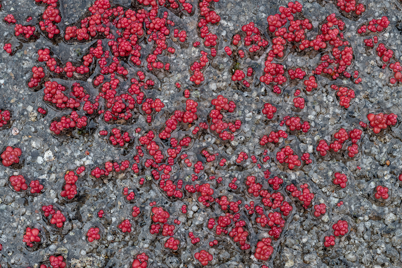

(Above): Elf Orpine (Diamorpha smallii) in early stages of development on a granitic flatrock in South Carolina’s piedmont.
Day One: April 20, 2022
It’s two o’clock in the morning and I find myself in the driver’s seat of my car heading south. I cannot count the number of times I’ve rolled this section of highway: Interstate 66 to Interstate 81. I left my boyhood home in Virginia at eighteen and I’ve been living or working in some capacity in the southeast ever since. The dark hours of early morning have always been my favorite time to travel.
Interstate 81 carries me from north to south along the western edge of Virginia. Somewhere around hour five or six I cross into Tennessee near Bristol. From there, I hook Interstate 26, climb over the mountains, drop into Asheville, and eventually end up driving west on two-lane Cherokee Scenic Byway (SC-11) towards basecamp at Oconee State Park. This gives me the opportunity to once again stop by a granitic flat rock near Liberty, South Carolina to check in on some plants that I hope are blooming. And I really need to stretch my legs anyhow!
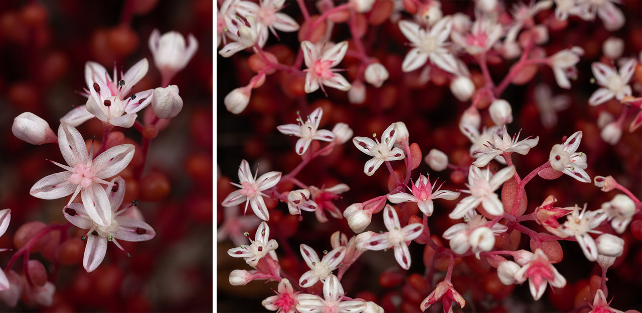
(Above): Flowering Elf Orpine in the Piedmont of South Carolina.
In the residual fog of overnight driving, I resist common sense and don’t put on my hiking boots. I decide, instead, to simply jump out of the car and begin exploring in my tennis shoes–a decision that would soon prove unwise. Only minutes after settling onto the sun-warmed rock to study some Elf Orpine blooms, a gentleman emerged from another section of the property. We struck up conversation and he told me that he was about to make rounds on some deeper sections of the flat rock and I was welcome to tag along should I desire. It turns out, this gentleman was an expert on granitic flatrock habitat, as well as this particular location. Not one to pass up an opportunity, I jumped onto his line and off we went.
Almost immediately we hit some of the vernal pools and spongy mosses that are characteristic of this place. My poor choice of shoes was immediately apparent with my socks and feet quickly becoming swamped. Day one–literally minutes into my photography adventure–and I’m a complete mess. I guess we’re off to a decent start!
After showing me around for the better part of an hour, my guide left me to my camera and headed off to another nearby flat rock to continue his own explorations. I headed back to the car, stripped off my damp shoes and socks, went directly into some flip flops and decided to head straight to Oconee State Park to setup camp.
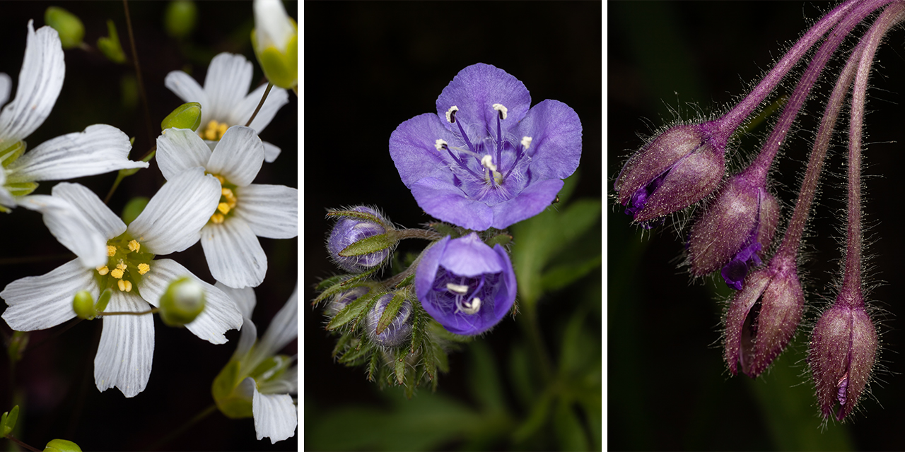
(Above): (left) Appalachian Stitchwort, (center) Purple Phacelia, and (right) Hairy Spiderwort.
By late afternoon, camp is all setup. My internal debate is whether to relax or to hit a trail. Many ask why I choose front country camping on photography trips. Security and convenience mostly. It’s important to note that my goals as a photographer are considerably different than the goals of other campsite visitors. I do not camp recreationally. I camp as a requirement of the job. Camping is economical and puts me closest to the areas I hope to explore. While most campers spend a night or two under the stars, I occupy my campsites, typically, for fourteen day stretches at a time. The mentality changes considerably, I think.
Still riding my first day high, I decide to hit the trail. I’ll sleep better for the efforts, I reckon. I drive over to the southern terminus of The Chattooga River Trail. Last year I found a considerable patch of Fringed Polygala along the Georgia side of the river. I pass wild Geranium and Foam Flowers aplenty. The Catesby Trillium are just beginning to bloom. As I drop down closer to the water, the species diversity seems to increase: Devils Bit, Galax, Dwarf Crested Iris, Green and Golds. My anticipation is met with excitement when I finally begin to see little pink, winged wildflowers: Fringed Polygala, or commonly, Gaywings.
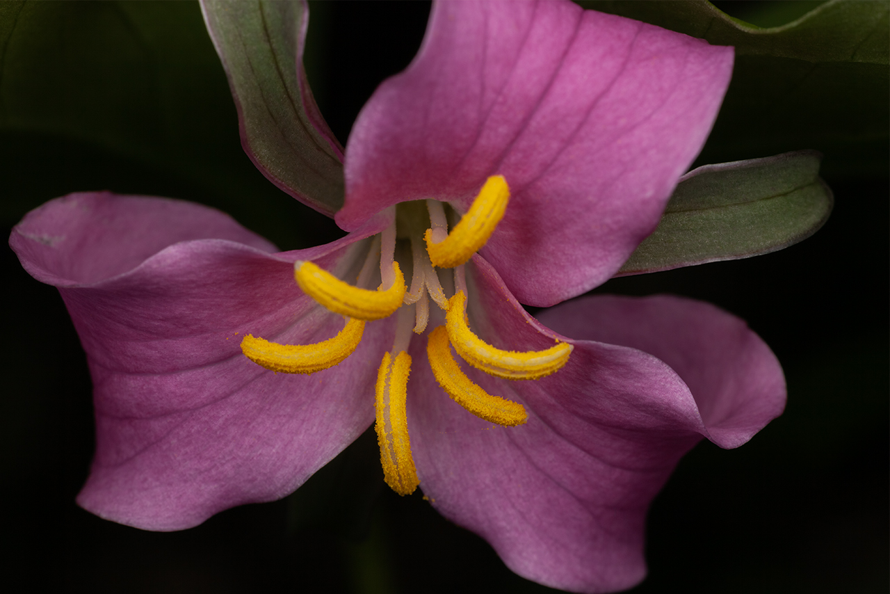

(Above): Catesby’s Trillium in both the common pink and less common white color forms.
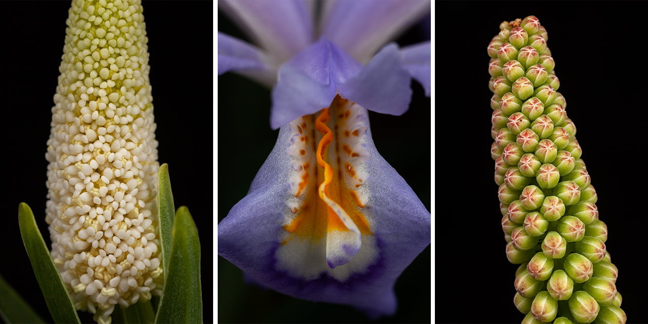
(Above): (left) Devil’s Bit early flower, (middle) Dwarf Crested Iris, (right) Galax flowers in bud
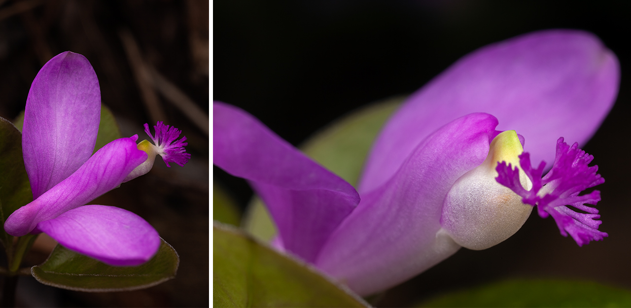
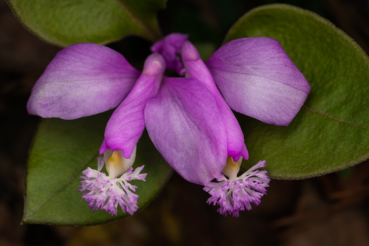
(Above): Fringed polygala, aka Gaywings, growing along the Chattooga River Trail in Georgia.
Day two: April 21, 2022
The slight chill in the air from the previous evening is gone. A warm front has moved in, bringing gray cloud cover. Today is scout day. I’ve got a photography client coming in tomorrow night. Preparation is a fools errand in this type of work, but I can’t help but go through the motions regardless. There’s a handful of waterfalls that I already know I want to show: Longcreek, Opossum, Brasstown, Lee. What’s more important today, however, is checking in on the fringe, or “maybe”, waterfalls.
First up, Sid’s Falls. My first visit to this waterfall was nearly twenty years ago on a meetup with fellow Flickr friends. The hike was virtually an off-trail experience, helped along by someone’s occasional blue marking tape strewn about in random tree branches. The trail today doesn’t need marking tape. It is obvious and well travelled. Side trails tempt hikers with choices. Social media and mapping technology together have driven different use patterns just about everywhere I travel these days. I’m not comfortable with the scarcity attitude that is emerging amongst many fellow photographers and outdoors folks. However, it’s more than fair to wonder what impact my photographs and this blog post might have on the physical environment going forward. Should I be more selective with the information I share?
Sid’s Falls is a beautiful, stepped drop. Like many waterfalls in Southern Appalachia, it’s base is often choked by fallen trees and chaotic with new growth. I find it thoroughly beautiful. And while I hadn’t planned on shooting much today, the overcast conditions and light winds beg the camera out of my bag.
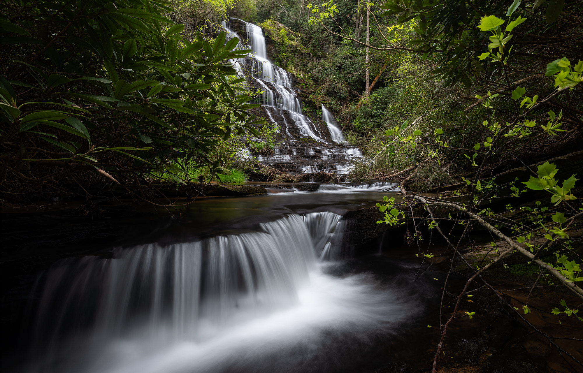
(Above): The cramped and chaotic quarters at the base of Sid’s Falls in Upstate South Carolina. Prints on Fine Art America.
On the return climb, I veer to the right down a side trail to Maxie Dukes Falls. This trail is a considerable downslope, equipped along much of it’s length with ropes. The base of the waterfall is absolutely cluttered with downed trees. The drop itself is another beautiful, high, stepped character. I cannot find many angles, however, to compose this waterfall beyond what feels, to me, a basic snapshot. Some waterfalls are just like that. I retrace my path up the trail, leaning heavily on the supplied ropes for assistance, and follow the logging roads back up to my vehicle. The last time I visited these waterfalls I was in my twenties and my camera pack was much lighter. And yeah, I’m clearly getting older :-).
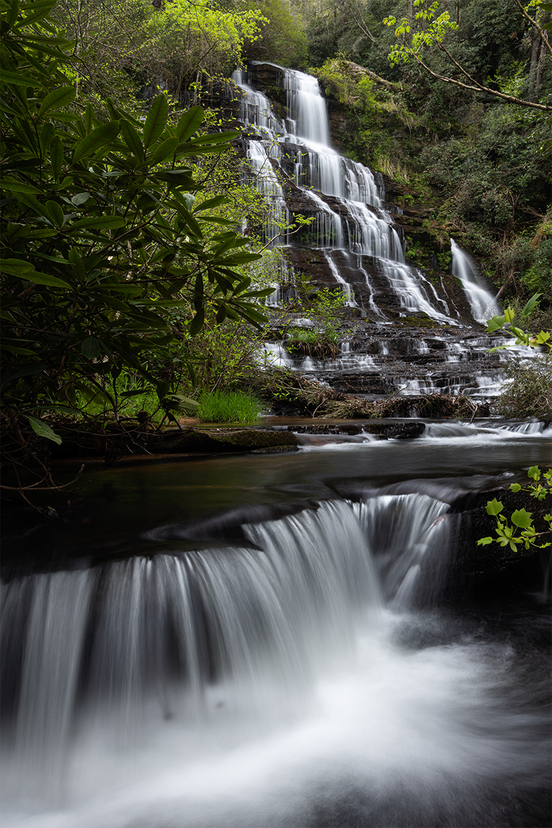
(Above): Sid’s Falls, Upstate South Carolina.
Following Sid’s Falls, I drive over to Fall Creek to scout another three potential waterfalls. First up, Andrew Ramey Falls. I find the top portion of the falls near the parking area to be very interesting, while the main drop I find to be a bit static with very limited foreground opportunity. Continuing downstream along the creek I eventually make it to Fall Creek Falls. Unfortunately, a large tree has fallen at the base of the waterfall. A smaller waterfall just downstream has suffered a similar treefall. The skies, at this point, are clearing and water photography is not in the cards anyhow. I decide not to continue to the confluence with the Chattooga River.
I find another beautiful spread of Fringed Polygala near Fall Creek Falls and cannot resist a bit of photography. All along the trail are great clusters of flowering heartleaf as well. There’s just something so satisfying about gently clearing the leaf litter from underneath the large, green, patterned leaves to find jug-like flowers on the forest floor! I must’ve gotten into my head a bit during the return hike, however, and missed the turn off for Pristine Falls. Before I know it, I’m ascending back up to the vehicle.

(Above): Fringed polygala, aka Gaywings, growing near Fall Creek in Upstate South Carolina.

(Above): Large-flowered Heartleaf near Fall Creek, Upstate South Carolina.
Day three: April 22, 2022
Goals for day three: (1) scout one sure thing waterfall to increase my confidence as a guide, and (2) get lots of rest and finish all chores around camp in advance of my photography client coming into town. I make the scout hike out to Longcreek Falls first thing in the morning, despite the quality of light being pretty poor. Longcreek Falls is a very wide waterfall with tons of room and options in the foreground. Not to mention, The Wild & Scenic Chattooga River is literally receiving the waters from the fall right at the base.
I’m pleased by the overall cleanliness of the waterfall; no debris whatsoever seems to be cluttering the drop. And I’m fascinated, as usual, by the swiftly moving water of the Chattooga River. Wildflowers are plentiful along the entire trail. I confirm my own confidence in this location as a must-see for anyone new to the area with an interest in water photography.
I head back to camp to clean up, cook some grub, do some laundry, and plant my face in a good book for a few hours before my client arrives. The scarce resource during any photography adventure is time. Thus, they tend to be fast and furious as we both attempt to pack as much value into as little time as possible.


(Above): (top two) The Wild & Scenic Chattooga River, Section IV; (below) purple dwarf iris, Upstate South Carolina.
Day four: April 23, 2022
Here we go! Off to the races. First up for our adventure is a very unique waterfall with tons of potential. We wake before dawn and prep some camp breakfast and coffee (well, not me actually…I typically fast until 9am every morning). Dropping the mountain into Walhalla, we grab the Cherokee Scenic Byway (SC-11) and head towards Tamassee. We’ll be working from the bottom of the Blue Wall this morning. Despite it being a weekend, we’re the first to arrive at the parking area.
A short hike through a series of experimental fields and creek crossings and we find ourselves in a deep cove with high stone walls. Tamassee Creek is plunging down a nearly vertical spray cliff, stepping through some smaller cascades, and shooting along a moss-covered shelf. This scene always tickles my creative juices. The closer to the action I can get, the better.
The wind, which was forecast to be gentle this morning, is not so. I guess the warming air is falling into the cove and sailing downstream. All of the foliage is aflutter. Still, it’s quite the scene. When my client finishes shooting up top, I toss my boots aside and get into the cool waters just as the sun works it’s way down the stone wall adjacent to the waterfall.
My shot quantity and quality always falls off when guiding photography adventures. As it should. It doesn’t matter how amenable the client is to me doing my thing behind the camera, my mind is still primarily set on planning the experience and thinking ahead to the next move.
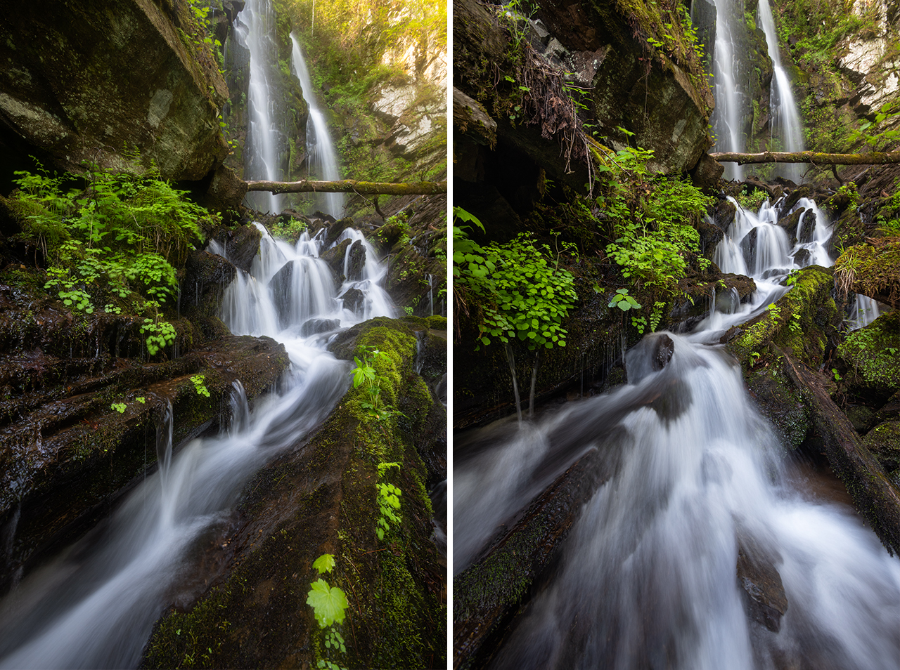
(Above): The incredibly lush Lee Falls, Upstate South Carolina.
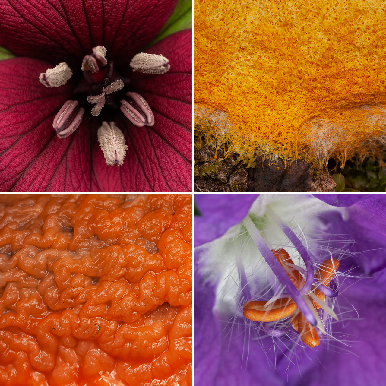
(Above): (upper left) Vasey’s Trillium, (upper right) Slime Mold, (lower left) Fusicolla Orange Slime, (lower right) Purple Phacelia.
Before returning to camp, we drive over to Nine Times Preserve for a short walk along The Trillium Trail. The ephemeral spring wildflowers were wonderful along Eastatoe Creek during my visit last month. Of particular interest this afternoon are the Trillium discolor, a species unique to the upper Savannah River drainage. We find a few, but the bloom on this particular afternoon is pretty underwhelming. On the other hand, we do find a really cool juvenile Walking Stick bug!
Following a return to camp and some late lunch, we spend the evening over at Brasstown Falls. Brasstown is a string of waterfalls–four to be exact–with the most exciting waterfall, to me at least, being a twenty-five foot veil. New trail improvements and observation decks make the experience very easy in comparison to past efforts.
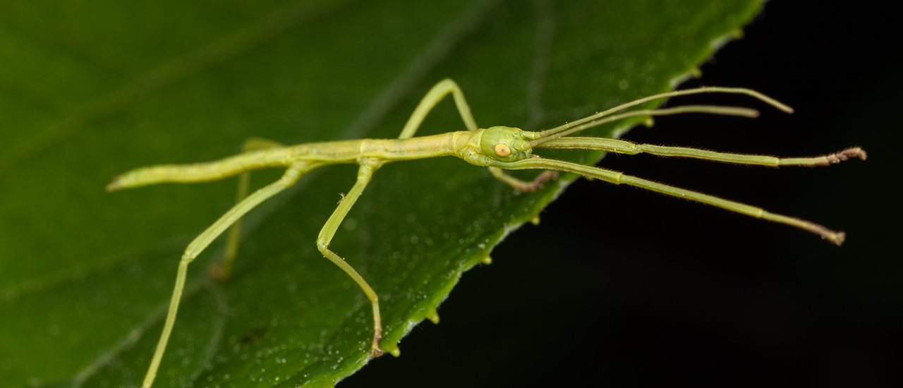
(Above): Juvenile Walking Stick insect found within Nine Times Preserve, Upstate South Carolina.
Day five: April 24, 2022
Up before dawn, breakfast and coffee (and a bottle of water for me!), and out we go to see another waterfall: Longcreek Falls. While gearing up in the small parking area before hitting the trail, we bump into fellow photographer, Tommy White, and his workshop crew. Great minds think alike! We all meet down at the bottom of the falls.
Longcreek is great. It’s a hit with everyone. Plenty of space to work around each other and lots of unique compositions available. After several hours, my client and I head back up the trail and decide to drop down to a waterfall that I had never seen or scouted before. The trail’s steep and the waterfall is a lush, mossy drip. We carefully feel out the area to safely cross the wet, slippery rocks to find a beneficial shooting position. Once there, however, we both have a blast working the lush, vibrant scene. My client mentions to me that this is his favorite waterfall so far! I know that I should adjust the plan based on the input. However, this is an atypical waterfall for this area and I simply don’t know of any comparables.
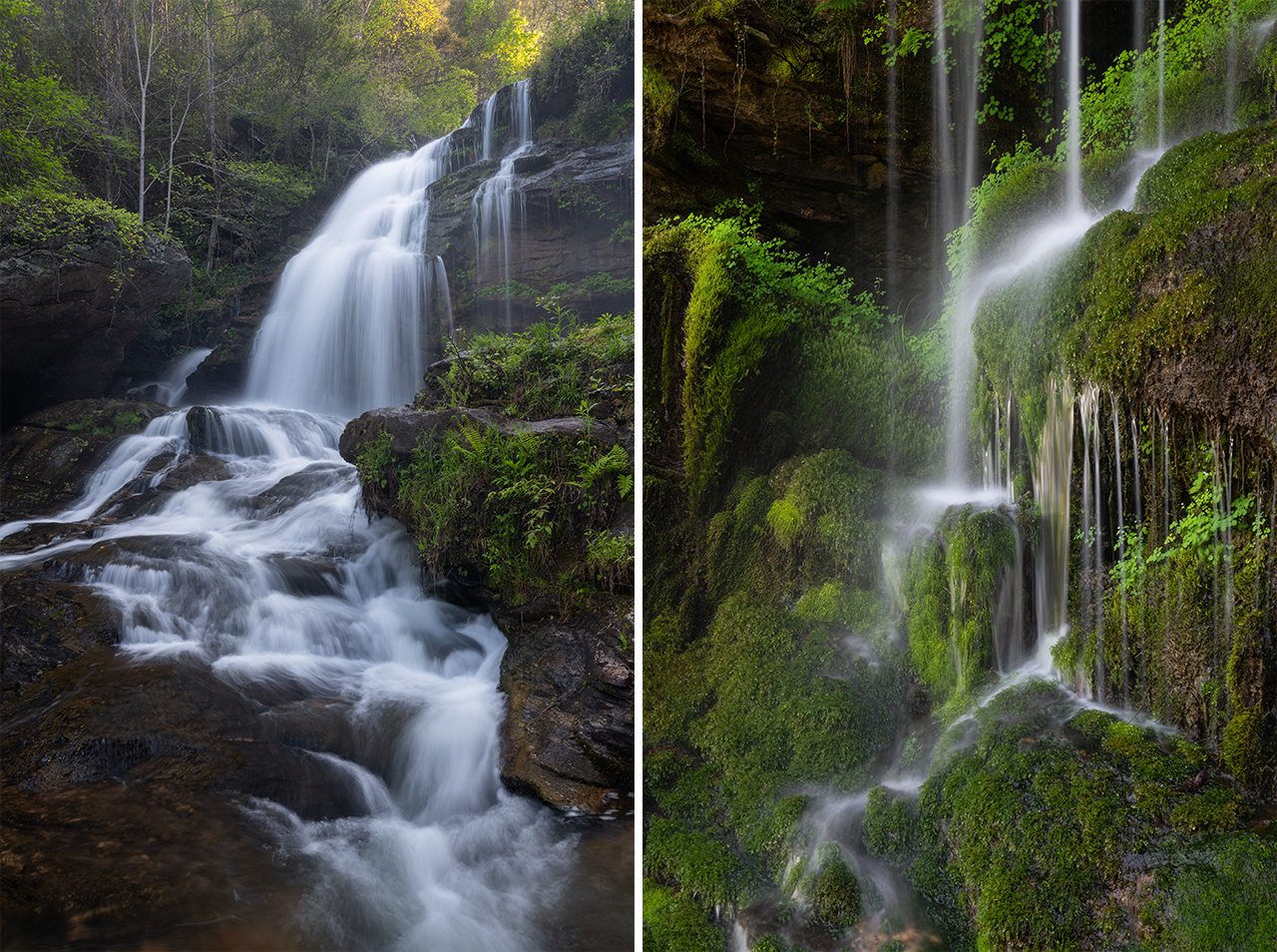
(Above): (left) Long Creek Falls, (right) mossy, lush waterfall, Upstate South Carolina.
Not ready to give over to the desire for rest and food just yet, we drive away from the Blue Wall and into the Piedmont to visit Ramsey Creek Preserve. This is an extremely unique property introduced to me by friend, Susan Stamey. Ramsey Creek Preserve is the first conservation burial ground in the United States. As I understand it, the process of natural burial is used as a mechanism to improve (or conserve) the land and habitat of the physical site while, arguably, creating a much stronger and more positive connection between humans and the land. For those interested in learning more, I’ll point you to their website, Memorial Ecosystems, Inc. for more in depth information.
What’s unique about this property, for us, are the botanical treasures. Upon arrival, my client and I are lucky enough to run into Dr. Billy Campbell, owner and caretaker of the land. He’s generous enough with his time and knowledge to lead us on a personal tour of the current blooms, leaving us jaw dropped at a plot of Trillium discolor numbering in the hundreds. It’s the largest single, tight-knit plot of blooms I’ve ever seen. Unfortunately, we’re here mid-day. It hasn’t rained in a week; pollen sits heavily atop the beautifully patterned leaves. A cloudless sky punches harsh light directly onto lightly yellow flower petals. There’s nothing we can do. No complex shooting techniques or computer hoodwinkery. It’s a spectacular sight, but it’s not the right time to make a picture.
After a brief rest back at the campsite, we make a run over to Woodall Shoals on the Chattooga River. Our hike at this location is more bushwack than trail. And after a log gives way underneath my client and sends him ass over tea kettle onto the sandy shores of the Chattooga, our pace begins to slow. We’ve been running hot for several days, clocking ten to fifteen mile efforts underneath full pack weight in high eighties humidity. The light doesn’t play nice for us at this location. A hot shower back at camp calls loudly.
Day six: April 25, 2022
Up before dawn, breakfast and coffee–a bottle of water for me. We’re both slipping into the routine of this photography adventure. It’s off to another hike and another waterfall. With steep geography like the Blue Wall, it’s almost guaranteed that any waterway will have many waterfalls along it’s course. The adventurous are generally rewarded here. For this one, I want to show my client a waterfall above a waterfall. Unfortunately, upon arrival, the almost non-existent billy goat trail that once existed is pretty much gone. Buried beneath forest downfall and complicated by muddy inclines. I scamper up to the upper falls just to have a look, but we focus our energies, instead, on the lower falls for most of the morning.
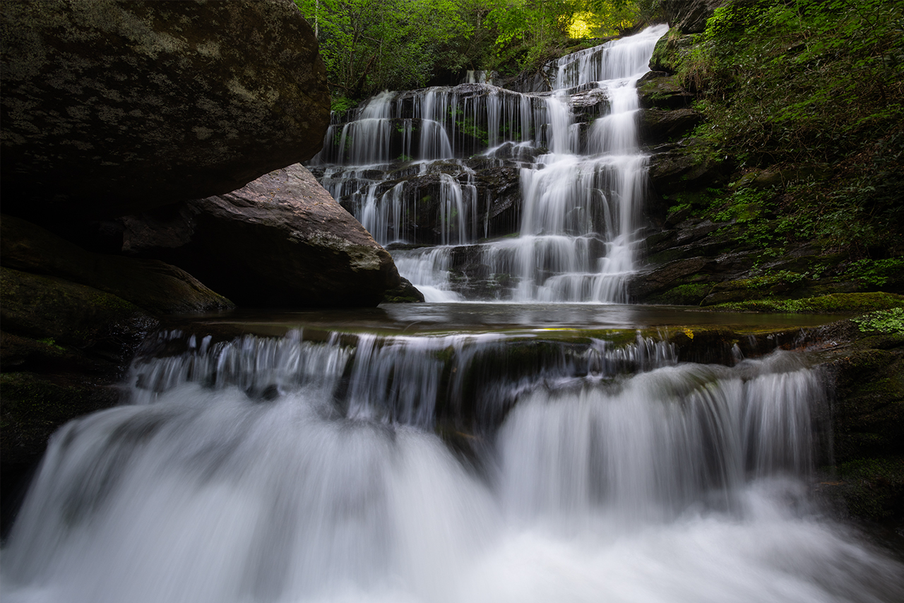
(Above): A waterfall above a waterfall. One of the many treasures along The Blue Wall, Upstate South Carolina.
After another six miles under our packs in high heat and we’re both gassed. My client sits underneath his tailgate near the trailhead and takes joy in listening to the migrating song birds. An application on his mobile phone lights up with the identification of a dozen different species: Vireos, Warblers, Black & Whites, Woodpeckers. We’re on a dirt road deep within heavily managed forest. A partially cleared plot to our right seems to draw the birds out of the forested canopy with opportunity.
Instead of another half-ass camp meal, my client and I recognize our waning energy stores and opt for a more substantial refuel. We drive up to the top of the Blue Wall in Cashiers, North Carolina to grab some lunch at a local mexican eatery. The food is delicious; the service great.
For our evening hike, we decide to spend some time down by the Chattooga in Georgia along Section IV of the Wild & Scenic River. We’re greeted by Dwarf Crested Iris and Catesby Trillium, and eventually, after another sweaty two-mile hike, we get onto some Finged Polygala. Last light finds us at Bull Sluice, arguably the most well-known of the cascades along the Chattooga.
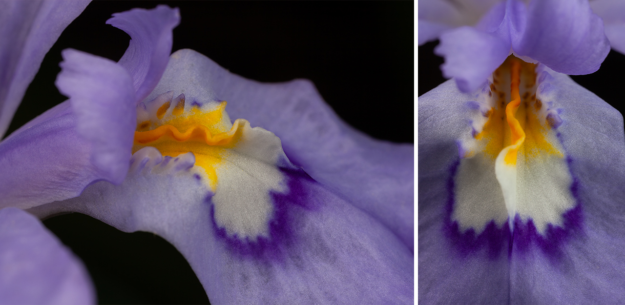
(Above): Dwarf Crested Iris along The Chattooga River Trail.
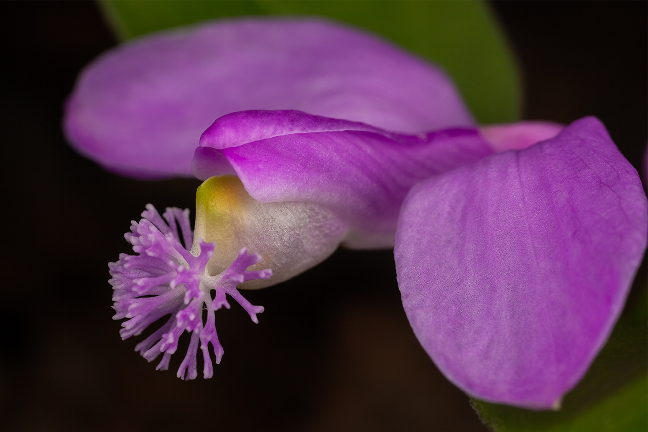

(Above): Fringed polygala, or Gaywings, along the Chattooga River in Georgia.
Day seven: April 26, 2022
Our final morning together on this photography adventure. My client breaks down his camp. We take a leisurely approach to the morning, eventually setting off for our final destination: The Chattooga Potholes. After several days of working big water down in section IV of the Wild & Scenic Chatooga River, we decide to drive up to North Carolina to dive into section zero, the headwaters.
The Chattooga Potholes are a really neat set of cascades near the iron bridge at Bull Pen Road. The river here cascades over a ten foot drop. Over time, the water currents and rain have swirled amazing round holes into the stone. While my client works these prominent foreground features, I do my best to stay out of the scene by using a medium zoom to highlight the small drop just upstream.
We continue along the Upper Chattooga Trail. Wildflowers regale us, as they have during our entire experience: trilliums, indian cucumber, jack-in-the-pulpit. We stop as desire calls. My client checks the weather on his phone; the radar is colorful and active. A storm seems imminent. The clouds up ahead seem to agree. We decide to head back. At the cars, we say our goodbyes and part ways. Until the next time.
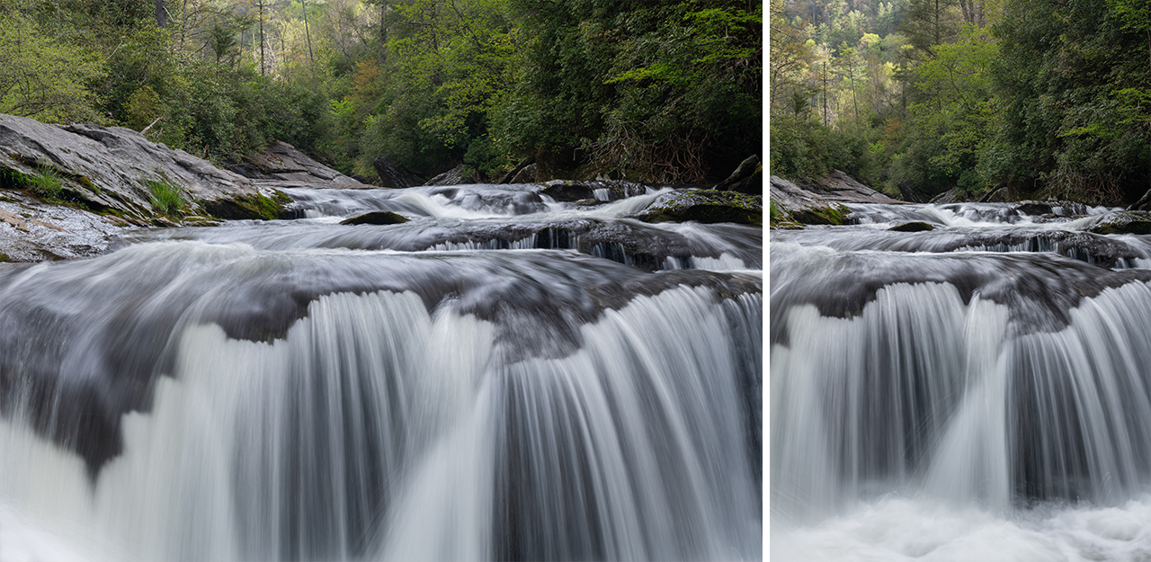
(Above): The Chattooga River Potholes at Bull Sluice, Western North Carolina.
I cross back into South Carolina. I let my mind relax. There’s no need to plan the next destination. I hope that my photography client feels that our experience met or exceeded expectations. It’s natural for me to wonder if I chose the right locations, set a proper pace, provided the proper feedback. Luckily, this particular client has become a good friend and our experiences have spanned a number of years. I don’t wish for this comfort to allow laziness on my part, however. I know that my clients have the ability to engage any of the numerous photographers in this area. I must continue to provide something different and something desirable.
My meandering mind and vehicle brings me to Brasstown Falls. The weather is teetering on the edge of rain. The skies are a bright overcast. I need a quick, easy hike after the past three plus days of running hard. A light drizzle drops as I descend the newly constructed trail. Forgoing the new platform, I toss my boots and put my tired feet into the cool running waters. It’s indescribable how tactile and amazing this is to me. In my fantasy world, I own property with a small stream and this simple act is part of a daily ritual.
I’ve waited the better part of twenty years for a particular piece of deadfall to clear the falls. It has not. So, best just to embrace it! I perch on the edge of Brasstown Sluice, the third of the three primary drops, and aim my camera toward Brasstown Veil. This frame was one of my favorites when I was learning photography twenty years ago. The familiarity is strange. You know what they say: the places don’t necessarily change over time, but you do.
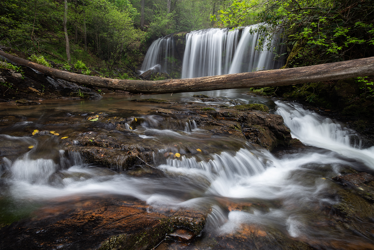
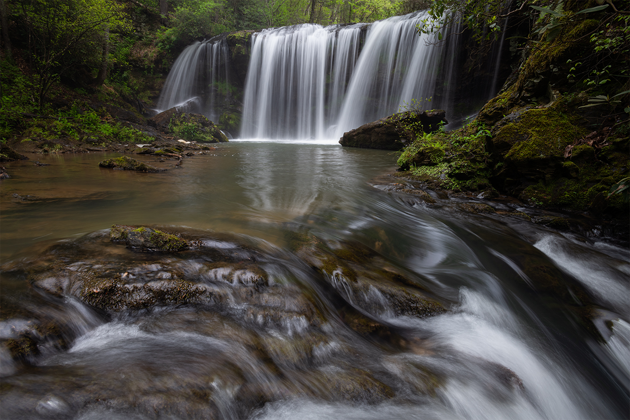
(Above): Brasstown Veil, part of Brasstown Falls, Upstate South Carolina.
Week one in the bag. I still have some more time on my ticket at Oconee State Park to explore the Blue Wall behind my lens. Stay tuned! More to come.


0 Comments